Ground shook again in Central Asia. On Thursday, July 2, 2026, a magnitude 4.7 earthquake struck Tajikistan, sending a clear reminder of how fragile this mountainous region really is. The National Centre for Seismology clocked the tremor at 6:50 AM IST. It hit at a depth of 122 kilometers, positioned at coordinates 38.265 N and 73.342 E.
If you are looking for immediate reports of flattened cities, you won't find them here. A depth of 122 kilometers is relatively deep, which means the earth absorbed much of the violent energy before it reached the surface. But focusing only on immediate destruction misses the larger, more dangerous story unfolding in the Pamir Mountains.
The Reality Behind the Numbers
People hear "magnitude 4.7" and usually shrug it off. In places like California or Japan, a 4.7 is barely a conversation starter. In Tajikistan, things are different. The country sits squarely on top of one of the most complex tectonic collisions on Earth.
The Indian plate is constantly shoving its way north into the Eurasian plate. This collision created the massive Pamir Knot, a dense cluster of towering mountain ranges that makes up the bulk of Tajikistan's geography. Because of this structural setup, the country deals with near-constant seismic pressure. Just weeks prior, on June 21, a magnitude 4.0 quake hit the exact same territory at a depth of 139 kilometers.
When tremors occur deep in the mantle, they rattle a wide area but rarely snap old concrete walls. The real trouble starts when these frequent intermediate quakes weaken already unstable mountain slopes.
Mountain Terrain Multiplies the Threat
Tajikistan is overwhelmingly mountainous. Over 90 percent of its land sits higher than sea level, and a huge chunk of that is high-altitude terrain. This extreme topography changes the math on seismic risk.
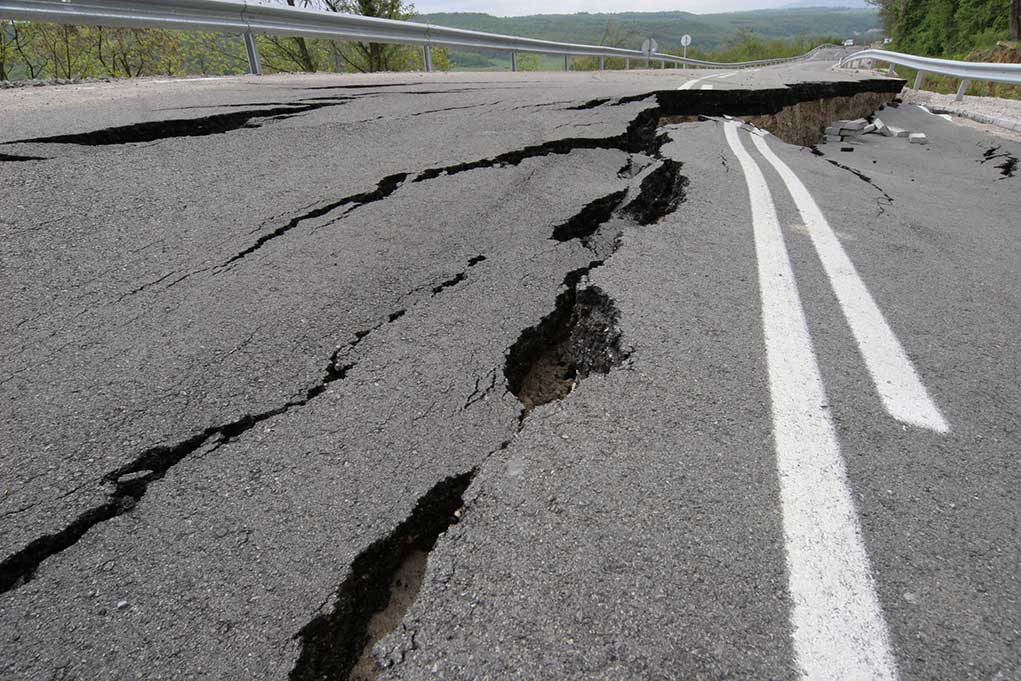
When a quake rattles a steep mountain valley, the immediate hazard isn't the shaking itself. The hazard is what loose rock and ice do next. Landslides, mudslides, and massive rockfalls routinely cut off entire communities. The country is incredibly isolated, tied together by a fragile network of mountain passes, aging bridges, and narrow roads.
If a single bridge fails along the main highway through Gorno-Badakhshan, relief efforts stop dead. Whole villages can end up stranded without food, clean water, or medical help for days.
Glaciers and Ground Shaking
The intersection of shifting tectonic plates and a changing climate creates a double threat that geologists are watching closely. The World Bank estimates that up to 30 percent of Tajikistan’s glaciers could vanish by 2050. As these glaciers melt at an accelerated pace, they leave behind vast lakes of unstable meltwater held back by weak walls of loose rock and dirt.
A sudden tremor can easily breach these glacial lakes. The result is a catastrophic flash flood or debris flow that tears down the valley, wiping out everything in its path. Traditional disaster planning treats earthquakes and floods as separate events. In the high valleys of the Pamirs, they are deeply linked.
Aging Infrastructure Faces the Test
Most of the housing and public infrastructure across Tajikistan's rural regions dates back several decades. Decades of minimal maintenance have left canals, dams, and concrete buildings vulnerable to repeated shaking.
Every small tremor acts like a hammer hitting a cracked wall. The wall might not fall on the first strike, or even the tenth, but the structural integrity degrades over time. Local builders and international relief agencies face a massive uphill battle. Engineering experts point out that rebuilding efforts must change. You cannot simply patch up a cracked wall and hope for the best.
Modern disaster mitigation requires blending real-time seismic data with climate models to construct smarter, flexible infrastructure. That means building schools and clinics away from known landslide paths and using flexible materials that sway rather than snap.
Next Steps for Regional Safety
Living in a high-risk seismic zone requires constant adaptation. Waiting for a massive disaster to strike before taking action is a losing strategy. Communities and local authorities need to focus on immediate, practical measures to limit future damage.
First, emergency communication networks in isolated mountain valleys must be upgraded. Satellite-based backup systems ensure that local leaders can call for help even if landlines and cellular towers go dark during a slide.
Second, community-led hazard mapping needs to become standard practice. Local residents often know which slopes look unstable after a heavy rain or a minor tremor. Combining this local knowledge with satellite imagery allows villages to establish clear evacuation routes before the next quake hits.
Ultimately, a magnitude 4.7 quake is a warning shot. It tells us that the mountains are moving, the ground remains unstable, and the window to reinforce vulnerable infrastructure is closing fast.
Watch this Early Morning Jolt reporting to see how this seismic event coincided with other major global tremors on the same day.